Published On Jan 21, 2024
In this video, we will learn together about GIS technology by answering the below questions:
What is GIS?
How is GIS used?
Who uses GIS?
How does GIS work?
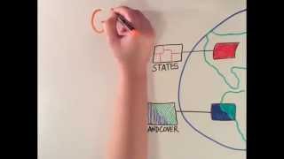
Geographic Information Systems (GIS) technology is a computerized system designed for collecting, managing, and analyzing data, rooted in the principles of geography. It seamlessly combines robust mapping and visualization tools with a comprehensive framework for data integration, analysis, and modeling.
GIS, firmly grounded in scientific principles, incorporates diverse data types and employs spatial location to organize information into layers within geographical visualizations, such as maps. This distinctive feature enables GIS to unveil deeper insights into data, revealing patterns, relationships, and contextual situations, thereby assisting users in making more informed decisions.
The true strength of GIS lies in its analytical capabilities. Through spatial analysis, it models and explores problems geographically, utilizing maps and data as the foundation. GIS not only addresses various circumstances, objectives, and organizational needs but also accommodates diverse data recording and quantification methods. Its unique capacity to integrate most data sets, using spatial location and digital map overlays, serves to organize and analyze relationships among different data types.
More than just converting information into intelligence, GIS possesses remarkable potential to foster connectivity among individuals across organizations and the globe through a shared visual language. Presently, thousands of organizations spanning diverse fields utilize GIS to tackle intricate problems. When data-driven maps are employed for communication, analysis, information sharing, and problem-solving, they fundamentally transform the way the world operates.
👍 Subscribe for more tutorials like this: / @beeilabtv
📺 RELATED VIDEOS
- Playlist with all our videos on GeoSpatial tutorials:
• Video
Other Social:
📸 Instagram: / beeilab
🌎 Website: https://mahdianpari.ca/
📱 Twitter: https://twitter.com/beeilab?lang=en
📝 LinkedIn: / beeilab
#BEEILAB #Python, #programming, #Coding, #pythonTutorial, #PythonCourse, #geospatial, #RemoteSensing, #GIS, #Geoscience, #AI, #ArtificialIntelligence, #geopython, #landuse #landcover #JupyterNotebook, #DeepLearning, #MachineLearning, #SatelliteImage, #ImageProcessing, #DataScience, #DataAnalysis, #DataVisualization, #SpatialAnalysis, #DataProcessing, #DataAnalytics, #DataMining, #ProgrammingTips, #AIProgramming, #GeospatialDataScience, #SpatialAnalysisTools, #PythonCode #qgis #remotesensing #satelliteimage