Published On Oct 12, 2019
Watch this video in 1080p HD for the best quality
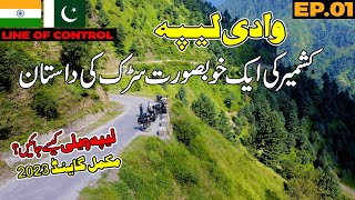
Travel Urdu Documentary/ vlog of Neelum Valley, Azad Kashmir, Pakistan India Border/ This valley is located along the Line of Control. While travelling in Neelum Valley, you can easily see the other part of Kashmir controlled by India. You will also see some Kashmiris waving at you across the river which serves as Line of Control
In this vlog we take you through some beautiful tourist places of Neelum Valley, Azad Kashmir. Our journey starts from Muzaffarabad and we travel through areas such as Athmuqam, Sharda, Kel, Arrang Kel and Taobat. We came across some spectacularly beautiful and scenic places while travelling through Neelum Valley. In this video you will see: tourist places in Neelum Valley, architectural design of houses in Neelum and some excerpts of Kashmiri people in Neelum Valley. You will also see magnificent Neelum River flowing between Azad Kashmir and the Indian Occupied Kashmir, serving as the Line of Control.
Neelum District (also spelt as Neelam; Urdu: ضلع نیلم), is the northernmost district of Azad Kashmir, Pakistan. Taking up the larger part of the Neelam Valley, the district has a population of 191,000 (as of 2017). It was badly affected by the 2005 Kashmir earthquake.
The Neelum River was known before Partition as Kishan Ganga and was subsequently renamed after the village of Neelam. It flows down from the Gurez Valley in Indian Occupied Jammu and Kashmir and roughly follows first a western and then a south-western course until it joins the Jhelum River at Muzaffarabad. The valley is a thickly wooded region with an elevation ranging between 4,000 feet (1,200 m) and 7,500 feet (2,300 m), the mountain peaks on either side reaching 17,000 feet (5,200 m).[5] Neelum Valley is 144 kilometres (89 mi) long.
Most of the valley is taken up by the Neelum District(Urdu: ضلع نیلم). The district is bordered on the south-west by Muzaffarabad District, which also encompasses the lower reaches of the valley; to the north-west beyond the mountains lies the Kaghan Valley in Khyber Pakhtunkhwa's Mansehra District; to the north and north-east are the Diamer, Astore and Skardu districts of Gilgit-Baltistan. To the south and east are the Kupwara and Bandipora districts of Indian Kashmir. The Line of Control runs through the valley – either across the mountains to the south-east, or in places right along the river, with several villages on the left bank falling on the Indian side of the border.
Tourist attractions include:
Arang Kel
Athmuqam
Chitta Katha Lake
Dhani Waterfall
Dowarian
Ratti Gali Lake
Halmat
Kel
Keran
Kutton
Sharda
Taobat
Jagran